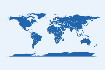
Build a ggsql query string that draws a choropleth from
a registered countryatlas source: the same idea as world_map(), but the
map is rendered in the database (DuckDB) by ggsql, which returns a plot
specification it can draw as SVG or as an interactive widget, so the
geometry never has to come back into R. Pure string builder with no
dependencies; pair it with as_ggsql_source() and ggsql::ggsql_execute(),
or drop the string into a {ggsql} chunk.
Usage
world_query(
  fill,
  source = "countryatlas_world",
  projection = "equal_earth",
  palette = "viridis",
  transform = NULL,
  title = NULL,
  draw = "spatial",
  layer = c("choropleth", "bubble", "binned"),
  facet = NULL,
  size = NULL,
  n_bins = NULL,
  geometry = "geometry"
)
Arguments
- fill
The fill column (unquoted or a string).
- source
The table/source name registered with ggsql (default
"countryatlas_world").- projection
A projection: one of the package's own names (see
projection_info()), all thirteen translated to ggsql's ("plate_carree"becomesequirectangular,"natural_earth"becomesnatural,"azimuthal_equal_area"becomeslambert, the polar views becomelambertcentred on a pole, and"gall_peters"a cylindrical equal-area CRS), or any other name ggsql'sPROJECT TOunderstands, passed through.NULLomits the clause.- palette
A scale ggsql's
SCALE ... TOunderstands (default"viridis"), orNULLto omit.- transform
Optional scale transform for
SCALE ... VIA(e.g."log10").- title
Optional plot title (
LABEL title => ...).- draw
The layer that draws the countries (default
"spatial").- layer
"choropleth"(default),"bubble"(proportional symbols at each country's centroid over the countries, which needssize) or"binned"(a classed fill, seen_bins).- facet
Optional column to facet the query by, e.g.
"year"for a small-multiple panel rendered in the database.- size
Column driving symbol size for
layer = "bubble".- n_bins
Number of classes for
layer = "binned"(default5); ggsql places the breaks, as close to this many as round numbers allow.- geometry
The source's geometry column (default
"geometry", the nameas_ggsql_source()writes).
Executing the query
Building the string needs nothing installed. Running it needs ggsql >=
0.5.0; the grammar was checked against 0.5.2, the first release on CRAN with
the DRAW spatial layer (2026-10-08). The query records that version as
its "countryatlas_ggsql_version" attribute, and
interactive_map()(engine = "ggsql") refuses an older ggsql. The
spatial layer also needs DuckDB's spatial extension, which
as_ggsql_source()(format = "reader") loads; ggsql's DuckDB downloads it
once per session, into the session's temporary directory. For
layer = "bubble" the source needs centroid_lon and centroid_lat
columns, which as_ggsql_source() adds for a frame keyed on iso3c.
Examples
world_query(gdp_per_capita, projection = "equal_earth",
            palette = "magma", transform = "log10",
            title = "GDP per capita")
#> VISUALISE gdp_per_capita AS fill, geometry FROM countryatlas_world
#> DRAW spatial
#> PROJECT TO equal_earth
#> SCALE fill TO magma VIA log10
#> LABEL title => 'GDP per capita'
world_query(gdp_per_capita, layer = "bubble", size = "population")
#> VISUALISE FROM countryatlas_world
#> DRAW spatial
#>   MAPPING geometry
#> DRAW point
#>   MAPPING centroid_lon AS lon, centroid_lat AS lat, population AS size, gdp_per_capita AS fill
#> PROJECT TO equal_earth
#> SCALE fill TO viridis